
There are two ways to extend the above walk. The first is to turn left after reaching Nathwaite bridge, and continue up the hill until you see a signpost pointing to the left across the fields to Gammersgill. Follow this footpath, and when the road is reached just before Gammersgill village, turn right on to the road and return to West Scrafton by taking the next road turning on your right via Nathwaite bridge. The second way is to take the left-
Local Walks which are not too difficult
The walks that are mentioned here are all shown on the Ordnance Survey Outdoor Leisure map 30, Yorkshire Dales Northern & Central areas which are on a 1/25,000 (2½“ to 1 mile) scale. Footpaths are indicated on this map by green dotted lines.
Walk 1
Go through West Scrafton village and take the uphill turning signposted “Swineside” on the left of a grass triangle. Continue up this road for about three-
Walk 2
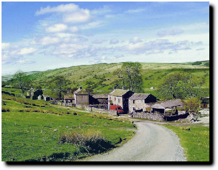
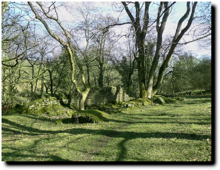
Swineside Village
As in the previous walk, go up to Swineside, but then, instead of passing through the hamlet, go between the two buildings facing you, across the old hotel car-
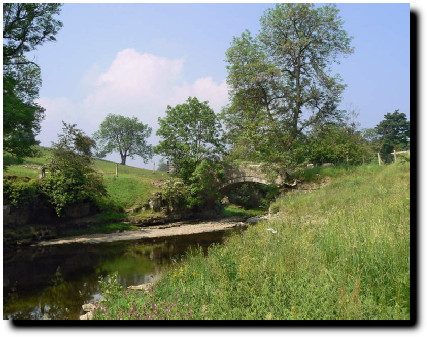
Nathwaite Bridge
Walk 4
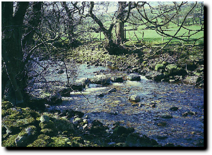
The Stepping Stones over the River Cover
For this walk you need to go through the small gate on the south-
Once again you need to start by going up the Swineside road, but this time carry straight on after crossing the cattle grid instead of turning down to the hamlet. This bridle path will take you over Hindlethwaite and Arkleside Moors and on the way you may find yourself surrounded by 3ft high ponies. After that slight diversion you can carry on and, after passing Dead Man’s Hill on your left, reach Scar House reservoir. It is about three miles from Swineside making the complete return walk about 9 miles.
Walk 6
Walk 7
This is a much shorter walk and from the village you go along to The Batt again and down Low Lane, the old drovers’ road. Follow it round and across the fields and you come back on to the West Scrafton to Coverham road. Turn left and continue down the road to the East Scrafton turning on your right. Opposite this is a signposted footpath on the left. Go over the stile and follow the footpath across the field and down the hill to St Simon’s Chapel which is on the banks of the River Cover. You can then continue over the bridge, taking one of two paths up the hill and soon reach the Carlton road; turn left, reaching Carlton in under a mile and you can then take the footpath on your left from the village back to West Scrafton via Caygill bridge. The whole walk is of the order of 4 miles.
Walk 8
There is a route across the fields to Middleham if you are so minded. Proceed as above to the East Scrafton turning and then take this turning towards East Scrafton. In about a hundred yards, before Corner’s House, turn left on to a signposted footpath and follow the track to Caldbergh. Beyond Caldbergh there are two alternative tracks, both coming out on to Hanghow Lane. Turn right up the lane and take the path on the left just before Braithwaite Hall. This will take you over Hullo bridge and up to Pinker’s Pond. For Middleham, turn right after crossing Hullo bridge and follow the footpath to Middleham. Pinker’s Pond is 4 miles and Middleham about 4½.
There are numerous variations to these walks. The Ordnance Survey map mentioned above indicates the routes clearly as green dotted lines. The green dashed lines represent public bridleways. Although these are public rights of way and are usually clearly signposted, it helps considerably to get the 1/25,000 scale map, as sometimes there are long distances across fields without any unambiguous indication of the correct way to go!
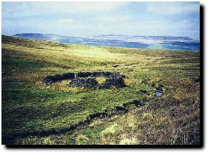
An old Sheep Pen on Roova Moor
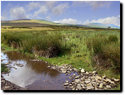
Beware the boggy moors!
The Remains of St Simon’s Chapel
Hullo Bridge
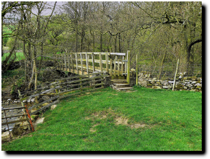
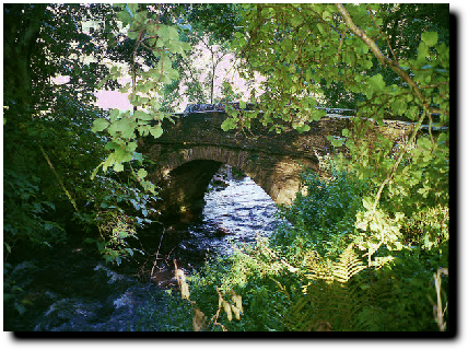
Caygill Footbridge
Walk 3
To Swineside and Nathwaite
2½ miles return
To Carlton via Caygill Bridge
2 miles return
To Horsehouse
5 miles return
To Gammersgill
3½ miles return
Up and Over Roova Crags
11 or 18 miles return
To Scar House Reservoir
9 miles return
To St Simon’s Chapel
4 miles return
To Pinker’s Pond
8 miles return
Walk 5


There are two ways to commence this walk. The first is to leave West Scrafton by the road to East Scrafton and then, in about one hundred yards, to turn down the track on the left by The Batt called Low Lane. This is the old drover’s road. Carry on over a set of steps and through a small gate into a field. Cross the bridge in the far corner and bear right with Caygill House on you left. Go through another gate and down the slope to Caygill footbridge. Then proceed as marked ** below..
Alternatively you can go through the village and down the “no through road” on the right. Then take the signposted track to Carlton (known as Back Lane) about a hundred yards down on the left between Lane End Cottage and Chapman’s Cottage. In about 60 yards, take the gate on the right and turn left at the end of the track to go along the side of a field. Go through a kissing gate and then down the slope to Caygill footbridge as before.
**Go over the bridge and then diagonally up the hill until you reach Carlton. You can return to West Scrafton via the road by walking up the hill through the village, bearing left at the top and then after about three hundred yards taking the road on the left signposted “West Scrafton”. The walk is about 2 miles.


WEST SCRAFTON